Australia / Asia / Pacific Turbulence Maps - 00 UTC
Map Information
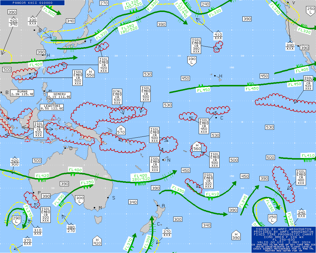
Dashed regions in light gray indicate possible moderate turbulence, while darker gray areas suggest severe turbulence. The numbers in the legend represent altitude ranges. A single hat symbol ( ) denotes moderate turbulence, and a double hat (
 ) indicates severe turbulence. Red areas highlight potential storms, which may also bring moderate turbulence. Black arrows indicate the jet stream, which can influence turbulence and flight routes. There are four maps available at any time, each valid for approximately six hours, based on UTC/GMT.
Need Help?
Get a personalized forecast for your flight