
Are you an Android developer and love the site? Contact us
updated (Apr 14, 2024)
(c) Turbulence Forecast 2023
How do forecasters predict weather for flights?
Updated November 14, 2023
There are many forecasting agencies for aviation around the world, and they all function in a similar way, specializing in the weather most common in their respective areas. Let’s look at how the Aviation Weather Center (AWC) in the US operates.
The AWC is located in Kansas City, Missouri. It releases warnings, forecasts, and detailed analyses of hazardous weather for aviation for current conditions on the ground and in the air, as well as for 2 to 4 days in the future. Nearly 80 experts provide forecasts for national and international aviation: for private pilots flying below 15K feet, for passenger jets traveling between 15K and 39K feet, and for private business jets flying up to 40K feet or higher. The AWC works collaboratively with other agencies to issue forecasts of expected convective events for the entire country and adjacent oceans every 2 hours. These forecasts, created through a combination of observation, advanced technology, modeling, and human expertise, are used by the FAA to manage aviation traffic across the country.
The AWC is one of two global World Area Forecast Centers and invests in developing and testing new technologies, such as the NWS Aviation Weather Testbed (AWT) to accelerate research, and continue to improve aviation weather forecasting accuracy. The National Center for Environmental Prediction (NCEP) serves as the information technology center for the National Weather Service. The NCEP prepares and makes available national forecasts and outlooks of weather and climate. Meteorologists currently generate weather forecasts for 3 to 5 days, soon to extend to 7 days. Climate predictions are made for 2 weeks out up to a year ahead, although those of course do not impact forecasting for flying conditions the next day.
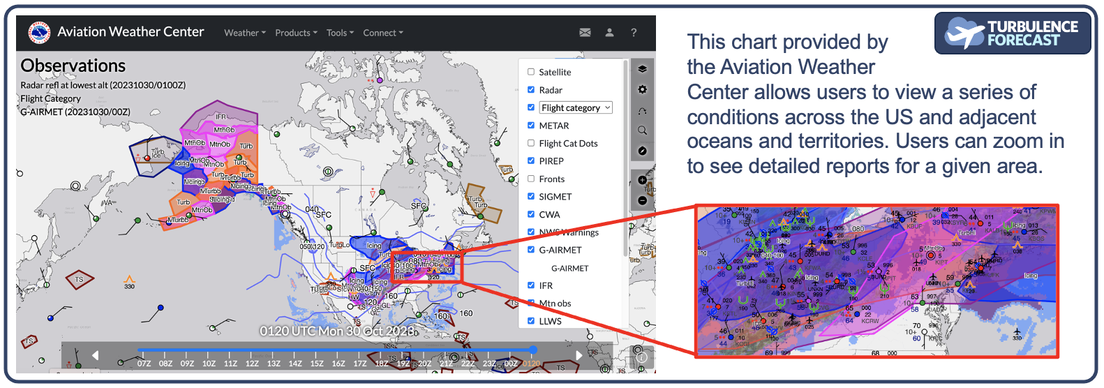
Agencies such as the AWC use meteorological data from multiple sources, such as ground stations, satellites, radar, weather balloons, pilot reports (PIREPs), and an ever growing number of numerical weather prediction tools, models, and algorithms to estimate the timing of weather events that can impact flying, such as turbulence, visibility, and storms. These agencies issue multiple types of charts, dashboards, and other mechanisms that flight planners, pilots, and interested lay people can use to plan routes, flights, and learn more about the weather on their route. This includes wind speed and direction, visibility, temperature, cloud cover, and others.