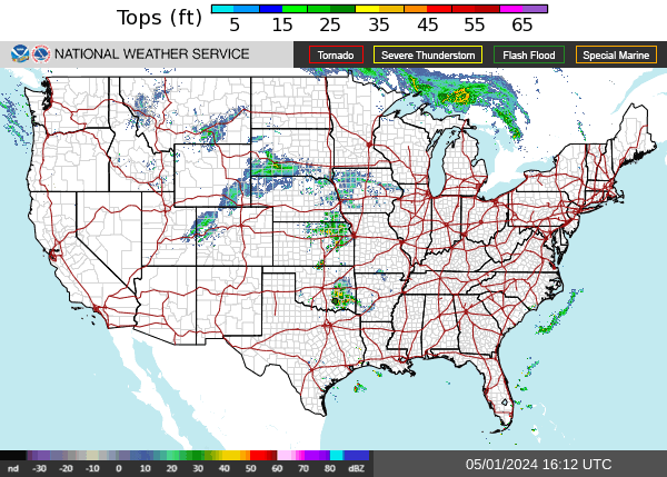
Map Information
The numbers in the radar legend indicate how high the storm is in thousands of feet, indicating if it's possible to fly over them.
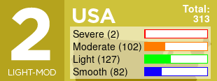
Need Help?
Get a personalized forecast for your flight
The numbers in the radar legend indicate how high the storm is in thousands of feet, indicating if it's possible to fly over them.
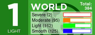
Need Help?
Get a personalized forecast for your flight