Request a Forecast
Simple. Detailed. Accurate.
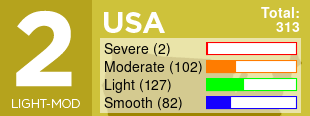
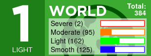
- Worldwide support for any airline.
- Storms and Turbulence up to 30 hours in the future.
- Updated with your actual flight path prior to departure.
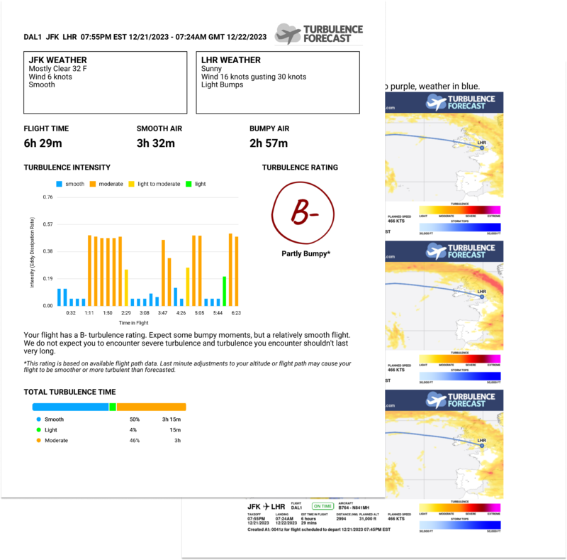
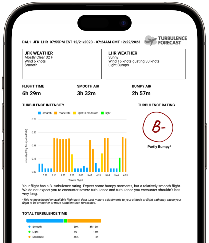
- Graphical route depiction and printable PDF summary - View Sample
- Get a forecast delivered to your email in less than 5 minutes for less than $5.
Ask the experts
Our experienced forecasters have been helping passengers understand turbulence and weather relating to their journeys since 2005. Have us sort through your flight route, relevant storms, turbulence, pressure systems and jet stream charts in order to deliver a concise description of what to expect on your flight. Starting at $49.99, satisfaction guaranteed.
- Any flight, public or private.
- Personalized to your specific needs.
- Easy to understand forecast in plain english.
Are you an Android developer and love the site? Contact us
updated (Apr 14, 2024)
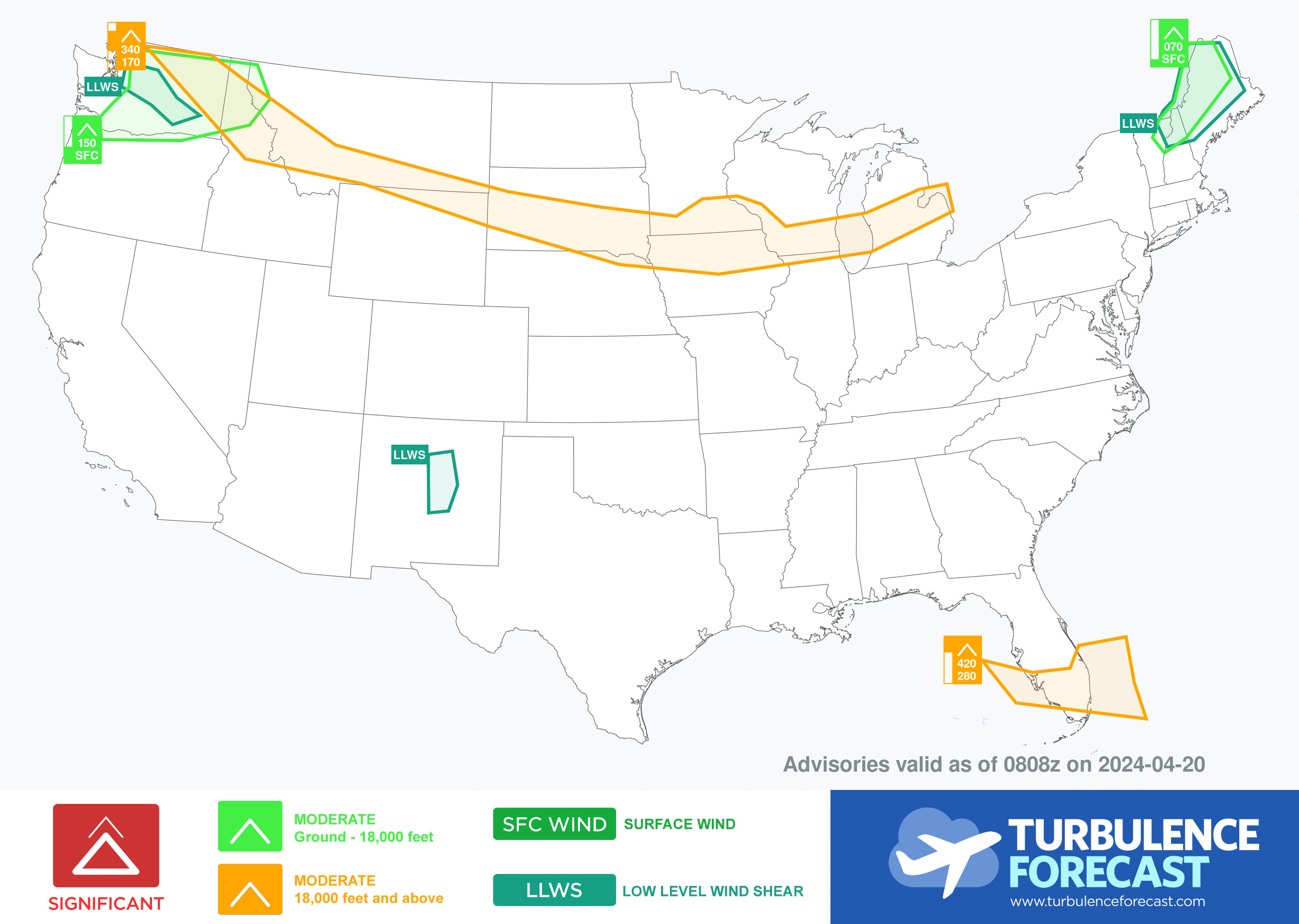
US Map of Potential Turbulence Areas
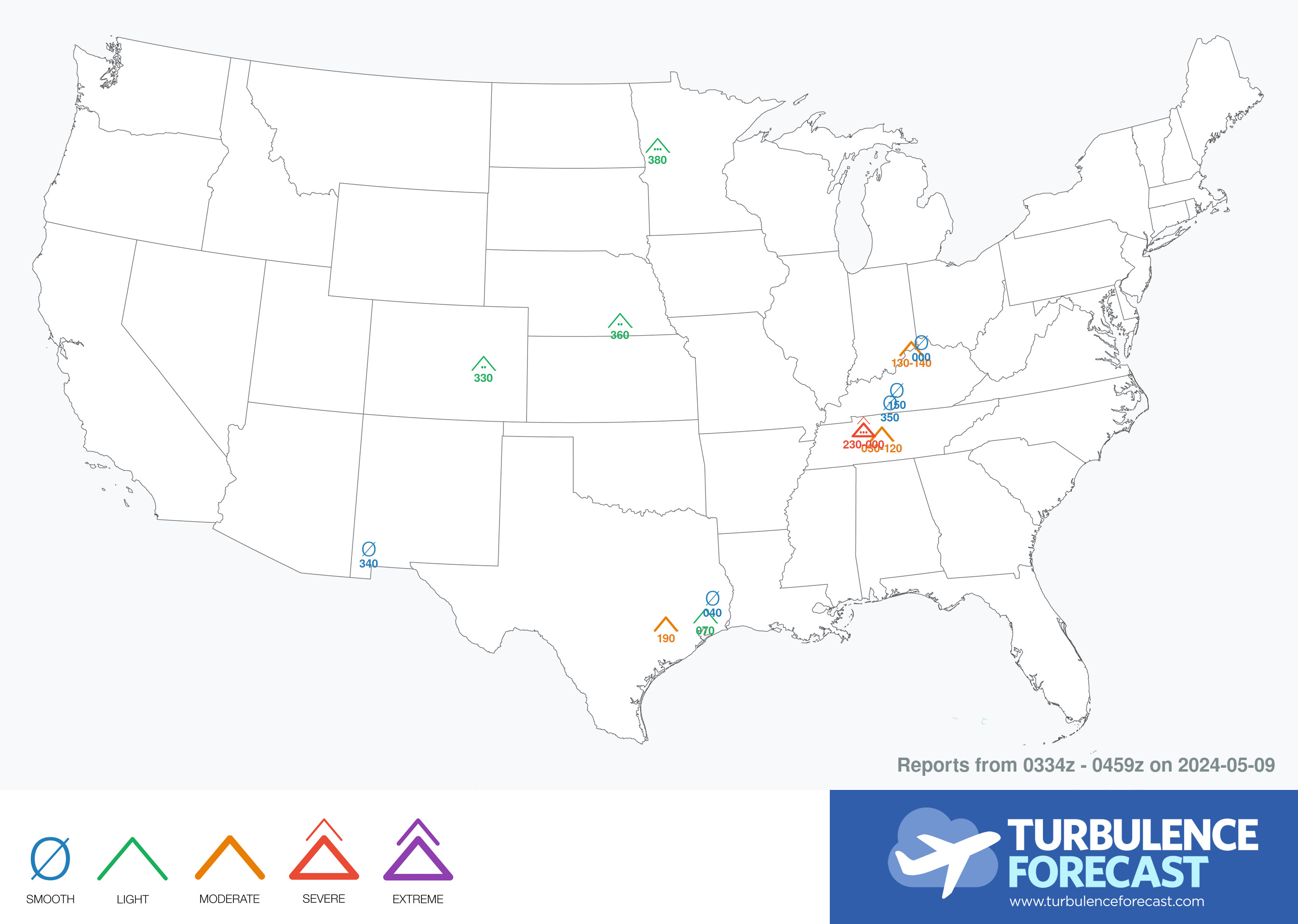
Pilot Reports
Want the best Turbulence Forecast has to offer?
Subscribe to get:
- Unlimited automated forecasts
- Deep discounts on personalized forecasts
- Full World Map access up to 30 hours in the future for all cruise altitudes 24,000 - 39,000ft
