
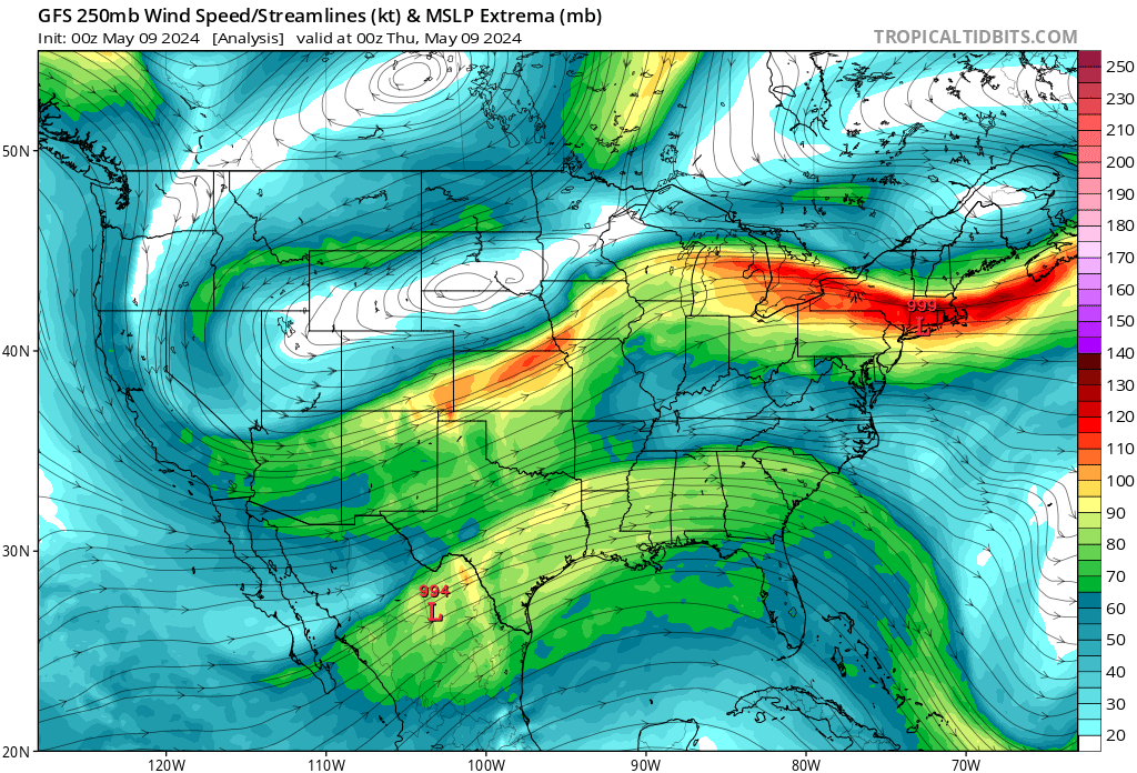
Map Information
These 250mb forecast charts are valid for an altitude of 35,000ft, typical of commercial flights. They are produced by Levi Cowan. Windspeed is depicted by colors on the right in knots (nautical miles per hour). If your flight path intersects an area where these colors change significantly over a short distance you can expect turbulence.
Need Help?
Get a personalized forecast for your flight